         |
Ernestina
Logbook Page
Date: Friday, June
16, 2000
Time: Morning
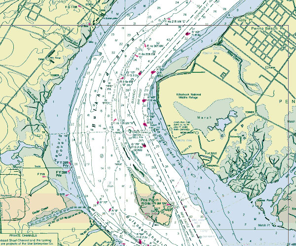
| Schooner Ernestina transited past the
eastern entrance to the C&D Canal, that's the
Chesapeake and Delaware, this morning with lots
of company. Ship traffic runs upriver to the
nearby ports of Wilmington, Camden and
Phildelphia and many tugs with barges in tow are
turning into the Canal. This
chart image shows the stretch of the Delaware
River just north of the entrance to the Canal.
The channel is referred to the "New Castle
Range" to ship operators as they speak to
others on marine radio. You can see the name just
east of Pea Patch Island. A range is a
navigational term for the situation when two
marks line up in a line. If you follow the center
line of the channel up to the top of the chart
image you will see a Fixed Green (F G) Light in
line with a Quick Flash Green (Q G) Light. The
captain can position the ship in the channel by
getting the two lights to line up by going to the
port or starboard as necessary.
Wind: Light
Visibility: Fair
Captain: Willi
Bank
Program Coordinator: Crista Mellican
|
 |
 |
We would like to thank Lotus and IBM
for donation of software, hardware and
funding to enable regular electronic updates
from the ship.
NOAA Chart
is provided courtesy of Maptech using
Cruising Navigator 4.3 and grabbing the image
using Grabit Pro 6.02.
|
 |
|
