| Schooner Ernestina came throught the C
& D Canal today into the Northern Chesapeake
Bay a little after noon and made her way about 12
miles south of Town Point Neck to the mouth of
the Sassafras River. This is likely the first
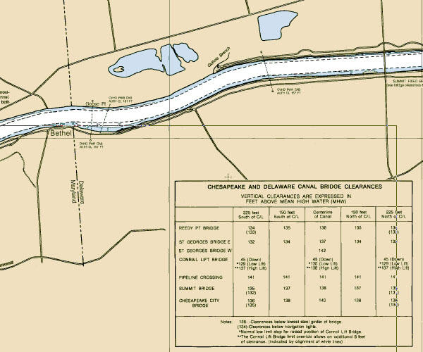
time the ship has transitted the C & D. Shown on the chart is a stretch of the
Canal at the Maryland/Delaware border. You can
see on the table that we need to think about our
"air draft" of 115' as well as our
"draft" of 13'. Clearances under power
lines and bridges generally are 135' or more for
the main waterways. The clearance is based a
distance at high tide (mean high water) while
water depths are based on low tide (mean low
water). Worst case, in general, but we still have
to watch the extreme tides.
The winds were light to nil
until this afternoon when they picked up to about
15 knots on our nose from the Southwest.
Wind: SW light to Force 4
Visibility: Fair
Captain: Amanda
Madeira
Program Coordinator: Polly Zajac
|