| Today started with a squal line passing
at 0500 with thunder and lightning strikes while
the ship lay at the dock at Tonnessen Park at New
Bedford State Pier. Luckily, the line passed by
0615 and we were able to set off under power for
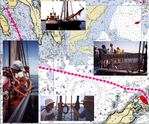
a full day of activities by 0630. The upper chart shows our transit with
crew aboard from New Bedford across Buzzards Bay
to the Woods Hole end of Naushon Island and
Hadley Harbor for a sail with many of the
extended family members of the Forbes family.
Commander Alexander Forbes served aboard the
Ernestina, then-Effie M. Morrissey, surveying
arctic waters in support of the effort to
construct airbases vital to the war effort in
WWII. Aircraft hopped across the Atlantic via the
bases for service in the war in Europe. Forbes
was aboard alongside Capt. Bob Bartlett who had
extensive knowledge and experience in the far
north. Our chief mate, Sophie Morse, is a member
of this family. It is great to have the
connections to the ship and the history deepen
and grow.
After boarding at 1000 by the
Cormorant, the ferry that serves Naushon Island,
68 persons sailed all day out into Buzzards Bay.
Winds were building from the SW but not enough or
from the right direction to allow us to sail all
the way to New Bedford. We hoped we could do this
simply because, historically, family members
would travel to the Island using New Bedford as a
jumping off point.
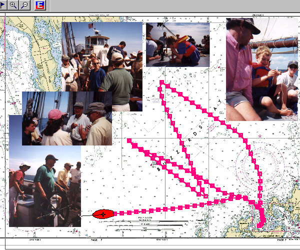
You can see on the second chart
the several tacks toward the west before
returning to Hadley Harbor by 1545 and a underway
transfer by the Cormorant (we didn't even strike
the main or fores'l). Photos will be up soon
after they are developed.... Check back soon!
After the drop off we sailed on
for Fall River and Fall River Celebrates already
in progress. You can see the beginning of the
sixty-five mile run take a tack over toward
Quicks' Hole to get a better angle on the wind
and to avoid numerous tug and barge combinations
transiting the Bay.
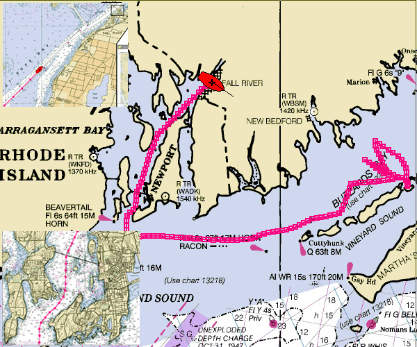
The final chart track below
shows the overall run from Naushon Island into
Rhode Island Sound, Naragansett Bay past Newport
(there is an inset in the lower chart of the run
past Newport and under the bridge) and 18 or so
miles on from there into Mt. Hope Bay and Fall
River.
The lower chart shows our
approach to Fall River at about midnight in the
inset. By now the wind has calmed completely with
moon out and pleasant night breeze. We tie up on
the west face of Fall River Line Pier near the
Battleship USS Massachusetts with Californian
already along side.
Wind: SW Force 3
Visibility: Hazy
Captain: Gregg
Swanzey
Program Coordinator: Crista Mellican
|